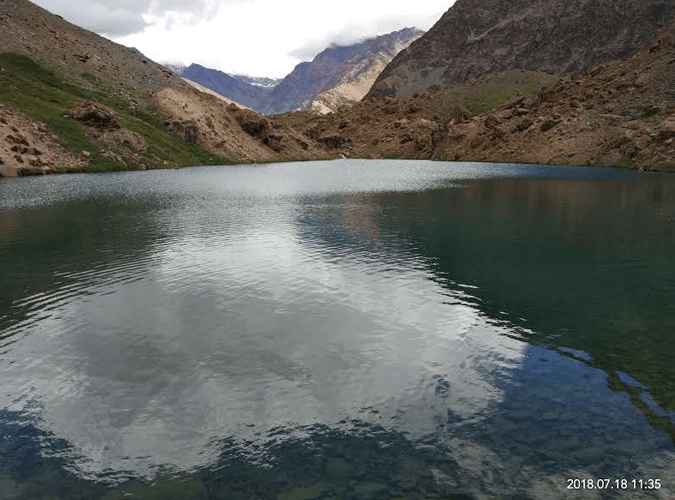
Nestled in the district of Lahaul in Himachal Pradesh, Yunam Peak Expedition is a breathtaking trekking expedition. This peak is situated about 20,300 ft. from sea level. It offers stunning views during a trekking journey.
Day 01: Arrival in Manali (2050m)
Day 02: Journey from Manali to Patseo
Day 03: Patseo to Baralacha Pass to Bharatpur
Day 04: Day of Acclimatization in Bharatpur And load Ferry to Summit Camp
Day 05: Trek From Bharatpur to Summit Camp
Day 06: Summit Camp to Yunam Peak Summit 6,111 meters and back to Summit Camp
Day 07: Summit camp to Bharatpur and drive to Manali
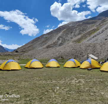
Accommodation. Day 1 hotel in Manali and Camp stay from day 2 to day 6 during the expedition.
Food in hotel day 1 Dinner day 2 breakfast.
Meals while on trek (Veg.+ Egg) From Day 1 dinner to Day 7 breakfast
Common Trek equipments: Sleeping bag, mattress, tent (twin sharing) kitchen & dinning tent, toilet tent, utensils and crampon (if required)
All necessary permits and entry fees.
First aid medical kit and oxygen cylinder for emergency.
Mountaineering qualified & professional trek Leaders, guide and Support staff.
Transportation from Manali to Bharatpur and back to Manali As per the itinerary.
Porter to carry the central luggage
insurance and GST.
Accommodation and meals in Manali on day 7.
Any kind of personal expenses.
Food during the transit.
Insurance.
Any porter to carry personal luggage.
Anything not mentioned in itinerary and inclusion section.
Here is the detailed Itinerary for Yunam Peak Trek
On day 1, you will arrive at Manali. You will spend the whole day amidst the splendid beauty of Manali with delicious meals and hot beverages. You can certainly explore some of the local spots of Manali on the first day.
You have to complete all the paperwork on the first day. Then you will meet our amazing team of Mountains Heights. Our team will explain the full Yunam Peak Expedition in detail. You will need permits for transportation for driving. We will collect all the required permits for the trekking journey.

Altitude gain: 2050 meters to 3,800 meters.
Drive: Manali to Patseo
Distance: 115 kilometers.
Duration: 4 to 5 hours.
The trekking journey will begin early in the morning around 9 am. We will start an exciting ride on the Leh-Manali highway. On the way, you will discover some of the hidden places. Snow-capped mountains, vast patches of green land, and meandering rivers will just drive anyone crazy.
We will pass through Tandi- the meeting point of rivers Bhaga and Chandra. Apart from Tandi, we will also get a chance to see Sissu village. One of the best places in Sissu village is Raja Ghepan Temple. Do not forget to capture these royal places on your camera.
We will now start our ride again and reach the Keylong/Jispa region. This region is about 120 km from Manali. Keylong and Jispa regions are home to Lahaul culture. We will stay in Patseo hot lunch and accommodation Patseo ridge back to campsite overnight stay in tent.

Altitude gain: 3800 meters to 4500 meters
Drive: Patseo To Bharatpur
Distance: 79 kilometers.
Duration: 4 to 5 hours.
Now, we have to begin our journey from Patseo and reach Bharatpur. You need to drive approximately 5 hours from Keylong to reach Bharatpur which is situated at a height of 4500m.
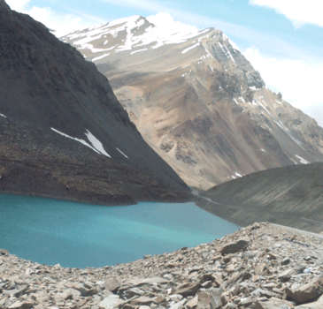
Bharatpur is again a beautiful place with a windy climate that is open during a particular period. We will make some stopovers in the middle of the ride. Our stopover will be mostly at Suraj Tal and Deepak Tal. Both these lakes are must-watch places for every trekker. You will feel the essence of the purity of these places during your ride.
One more place to see is Baralacha La. It is a spellbinding place that will hold your breath. You will just be lost in seconds after entering this elegant mountain pass. Click some pictures with your buddies to store these golden moments.
After Baralacha La pass, we will start driving and reach Bharatpur by 2 pm. You can try some of the most delicious local foods in Bharatpur. There are various stores in Bharatpur selling trekking equipment and trekking gear.
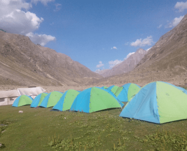
We will spend the rest of the day in Bharatpur itself and stay in tents at night.

Altitude: 4500 meters
Trekking distance: 4 hours
Trail type: mostly rocky
Difficulty level: easy
Water source: near the campsite, every participant should refill their Water bottles from the Campsite.
On day 4, you have almost reached an altitude of 4600m from sea level. It is quite high and you will start feeling some changes in your body as well. Some trekkers might feel tiredness, nausea, headaches, or loss of appetite.
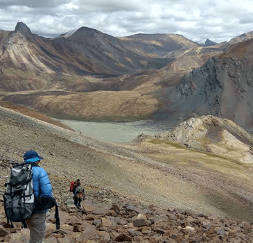
We have kept day 4 as Acclimatization day. Your body will get adjusted to the thin air and low temperature. It is necessary to consume liquids for the whole day to reduce tiredness. Moreover, you must do some light exercises to keep your body going.

Altitude gain: 4500 meters to 5200 meters.
Trekking Distance: 5 kilometers
Trek duration: 4 to 5 hours
Trail type: little rocky
Difficulty level: moderate
Water source: no water source during the track every participant should carry at least 2 liters of water from Bharatpur Campsite.
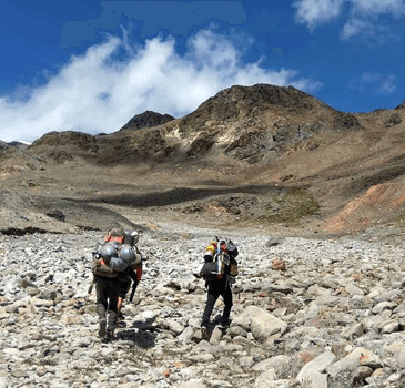
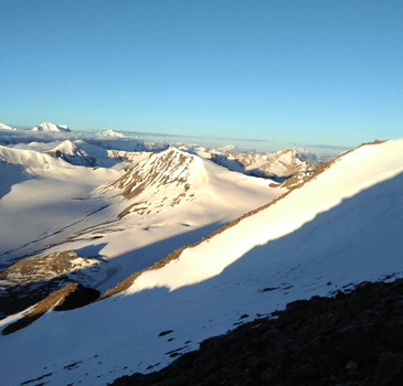
It is day 5 and now our challenging trekking part starts. We will start our trek early morning. Be ready to face some adventurous experiences on this journey. You have to trek on a steep mountain patch with an accent curve. This patch is 4.5 km in length and will be a real challenge for beginners.
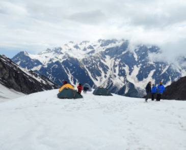
The sedimentary path might cause slipping accidents, especially among beginners. So, we advise trekkers to wear crampons for passing this specific rocky patch of the mountain. Gradually, you will land on snowy patches of the climb.
You do not need to carry water bottles as there are several water points on this route. We will get a water stream at every turn.
We will reach Base Camp around noon. After reaching Base Camp, enjoy meals and take photos with your group. As we have to begin our trekking around 4 in the morning, we advise you to get a good sleep.

Altitude gain: 5200 meters to 6111 meters.
Trek Distance: 7 kilometers on both sides up and down.
Trek Duration: 8 to 9 hours.
Trail type: Snowy or rocky
Difficulty level: challenging
Water source: no water source, everyone should carry at least 2 liters of water from the summit camp.

Today, we have to travel a journey of about 8 hours. You will meet some of the biggest odds and difficulties today. Trekkers have to cross about 6.5 km on a steep climb. This particular patch of the mountain is rocky and moraine. It is covered by snow and you might find it tough to walk on these snowy patches.
You will have to carry around 5 liters of water in your backpack. It is because there is only one water point on your route. Cold wind and high altitude will make you feel tired every few hours. So, it is necessary to take some rest every few hours.
After trekking for about 6 hours, you will now experience another tough edge of the route. This climb is fully covered with snow. So, it is necessary to bind up the harness to move properly. The summit will come after a stretch of moraine climb.
By reaching the summit, you will feel like you are on top of the world. The panoramic views are just indescribable. The sun-kissed snowy mountains of Chandra Bhaga and Mulkila Range will make you feel each moment alive.
Snowy mountains are welcoming with bounties of whiteness all around you.

Altitude Loss: 5,200 meters to 2050 meters
Trek Distance: 8-kilometer descent.
Trek duration: 5 hours
Trail type: mostly rocky
Water source: carry water from the campsite
Drive: 175 kilometers
Drive Duration: 7 to 8 hours
We have to rest at Base Camp on day 8. Then we have to drive about 7 hours from Bharatpur and reach Manali by 7 pm. After reaching Manali, you can plan your journey accordingly.
© 2024 All Rights Reserved - Mountains Heights