A mountain that is situated in the Pir Panjal range is famous as Deo Tibba. The mountain is located southwest of Manali and above the village(Jagatsukh). The height of Deo Tibba is 5985 meters and is in Kullu District.
Day 01: Manali to Khanol and Trek to Chika
Day 02: Chikka to Seri
Day 03: Seri To Base Camp (Tainta Camp)
Day 04: Training Day
Day 05: Load Ferry to Camp 1 Back to Base Camp
Day 06: Deo Tibba Base Camp to Camp 1
Day 07: Camp 1 to Summit Camp
Day 08: Summit Day and Back Camp 1
Day 09: Buffer Day
Day 10: Camp 1 to Deo Tibba Base Camp
Day 11: Base Camp 1 to Chikka
Day 12: Chikka to Manali
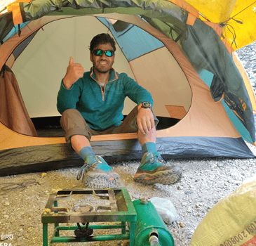
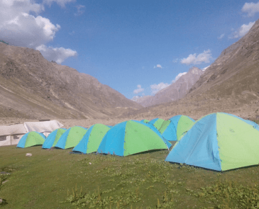
Comfortable stay in some/alpine tents during the expedition
Permissions of local authorities and entry fees fees.
Trekking insurance of our participant.
Permission of IMF.
Mule/porter for common equipment.
Oxygen cylinders and fully equipped first aid box.
Any personal expenses.
Stay of last day in Manali hotel.
Porter for personal belongings.
Any item not mentioned in includes section.
Personal trekking equipment like, trekking shoes, jacket, trek pants, and backpack etc.
Any SighSightseeing.
Here is the detailed three days Itinerary for Deo Tibba Trek
Altitude Gain: 2200 Meter/ 3500 Meters
Drive Distance:15 Kilometer.
Trek Distance: 8 Kilometer
Trek Duration: 2 to 3 hours
Trail Type: Initially the area has little climbing in the alpine forests and is covered with grasslands in the last half-hour trek)
Difficulty Level: Moderate to Challenging
Water Sources: Ample water sources.
Are you all prepared for the initial day of trekking? Initially, we will begin with a drive to khanol and then a trek to Chikka. There are numerous beautiful screenies as the place is ravishing so do not miss the beauty during the drive. This beautiful village has umpteen colorful houses that will refresh you for the trek. The drive from Manali to Khanoll is not that much longer but it’s mesmerizing and will uplift your mood.
There is a famous adventure site that is just before Chikka, which is Sethan. The place is known for rock snowboarding and rock climbing. There are hydropower projects that have big tunnel doors on your way. The trek begins as soon as you reach khanol. There is a climb through the green forests that have dense Oak and deodar alongside. There you will see a vast variety of vegetation that has wildflowers, herbs, and berries. The starting of the trek is a little steep and then you can walk normally. You will reach the campsite in almost 2-3 hours where you will see a beautiful temple and some huts in Chikka. You can enjoy the captivating view of Deo Tibba, Spiti Valley, and Indrasan peak while staying in your tents at Chikka.

Altitude Gain: 750 Meter/ 2400 Feet
Trek Distance: 7-8 Kilometers
Trek Duration: 5.5 to 6 hours
Trail Type: Walking forest with meadows and huge rocks
Difficulty Level: Moderate
Water Sources: Sufficient water
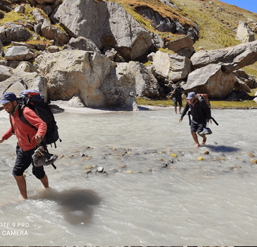
The area is so revitalizing, that you will wake up fresh for the next day's trek to Seri. The trek is full of stones and will be through the Jagatsukh Nallah. We will trek along the tree line to reach Seri alpine meadows. The beginning of the trek will have heavy forests but later on, you will see the forest getting scattered and scanty. Be careful as the season is rainy, the stones get slippery so walk slowly on the big boulders that will be there after an hour of your trek.
Suddenly you will observe the splendor of hardy trees and a ground that is full of meadows. It is Seri, and the camp is just a few more kilometers from the alluring place. A bouldered section is visible after 3 km of the walk and the place is Panduropa where your camps are waiting for you. You may see a freshwater spring that will be pleasing and enjoyable at Panduropa. The camps are placed to give a better view of the cliffs of Norbu, Malana Pass, Jagatsukh, and some parts of Deo Tibba Peak. Enjoy the night at the campsite along with the bonfire.
Altitude Gain: 650 meters/2200 feet
Trek Distance: 8 Kilometers
Trek Duration: 5-7 Hours
Trail Type: The trek is mixed as there are walking grasslands and also steep climbs.
Difficulty Level: Challenging
Water Sources: Adequate Water
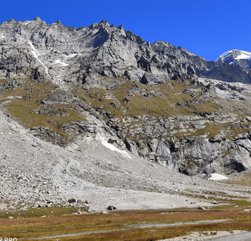
The trek will begin after you are done with your breakfast. Today's journey will be a little harder than the earlier ones. As you walk along the Jagatsukh river, you will observe a monument and a waterfall, both are beautiful in their own way. On the way, you have to walk through a steep cliff for around 2 hours. The passage gets over as you reach the moraines. After a small walk of an hour, you will be there at the base camp that is Tainta Camp.
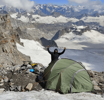
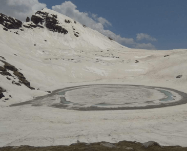
After the camp is established, we will move on to the Chota Chandratal. You ought to climb for approximately 2 hours to reach base camp 2. You will see a lake that is covered with wildflowers and also the peak towers of Deo Tibba. Further, we will return back to our base camp. The sky is vivid here and the camp is a closed valley and is not similar to the previous camps.
After reaching a height of 4200 meters, it becomes vital to take a day halt.
It is quite dangerous for a person to cover distances so quickly as it leads to sickness.
Let your body adapt to the environment and enjoy the lovely place.
You can go to Chota Chandartal for a walk and can even just chill and relax at the camp. A briefing session will be organized in the evening to explain further plans.
Altitude Gain: 600 meters/2000 feet
Trek Distance: 0.6 Kilometer
Trek Duration: 4 to 5 hours
Trail Type: Moderate to steep Climbing
Difficulty Level: Challenging
Water Sources: Have to carry an adequate amount of water.
Load Ferry means when you go to work at high altitudes but at the latter part of the day come back at low altitudes to sleep. You will carry all the vital types of equipment along with you to the higher camp and later will return to base camp 2.
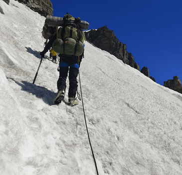
This is because high altitudes are different from the plains so it is important to return to lower levels. The lunch will be packed on the way and have enough water. Base camp 2 is at the Dhanuan Pass and the location is visible from Base Camp 1 due to its orange color. Initial 200 meters of the trek you have to go through moderate climbing, further 300 meters there is steep climbing and the rest of the 100 meters have a flat slope. The slope is covered with snow, so you have to go slowly as it gets slippery. Be careful while walking as there are deep cracks. After completing your lunch, you have to walk down to base camp 1.
Altitude Gain: 600 meters/2000 feet
Trek Distance: 0.6 Kilometer
Trek Duration: 4 to 5 hours
Trail Type: Moderate to Steep Climbing
Difficulty Level: Challenging
Water Sources: Take enough water along with you.
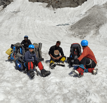
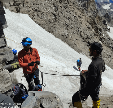
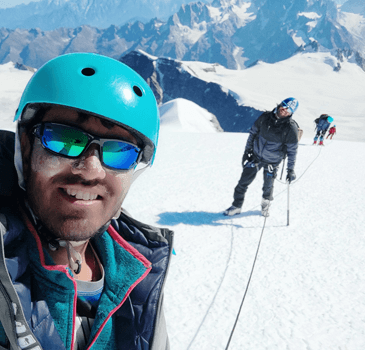
Now, you are ready to move to base camp 2. You have to follow the same trek route that was completed a day before. Walk slowly and have enough rest and the journey is 4-5 hours. Be careful as there are rocks, snow, and deep cracks. Make sure that you are walking along with the guide and team to avoid any kind of uncertainty.
Altitude Gain: 500 meters/1600 feet
Trek Distance: 4 kilometers
Trek Duration: 4 to 5 hours
Trail Type: Area covered with snow
Difficulty Level: Moderate to Challenging
Water Sources: Carry hot water
The body must adapt to the environment so this will again be a load ferry. After the visit, we will come back to base camp 2 as there are chances of a lack of oxygen at higher altitudes. The area is full of snow so carry your waterproof clothes and gloves along with you.
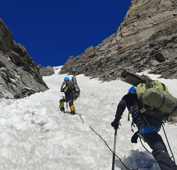
Due to snow and climbing, there are chances of slippery surfaces so make sure you come along with your guide and team. The first hour of the trek has moderate climbing which will get steeper in the later hours. After spending some time at the summit camp, we will move back to base camp 2 so that nobody faces any health issues.
Altitude Difference: 500 meters/1600 feet
Trek Distance: 4 Kilometers
Trek Duration: 4 to 5 hours
Trail Type: Snow Area
Difficulty Level: Moderate to Challenging
Water Sources: Carry hot water
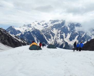
The same routine that was followed a day prior will be done to reach the summit camp. Carry only the items that you need and leave the rest of the things in base camp 2 which will save you from carrying heavy luggage. The load ferry rule is vital in the case of trekking at higher altitudes as it saves a person from any sort of health issues. Walk slowly and along with the team as the area is covered with snow and there are chances of falling. You can have a good time in ice sports and skills. The night will be adventurous at the Summit Camp.
Altitude Gain: 400 meters/1300 feet
Trek Distance: 6 kilometers
Trek Duration: 4 to 6 hours
Trail Type: The summit is wide but becomes steep at the end
Difficulty Level: Challenging
Water Sources: Have adequate water with you
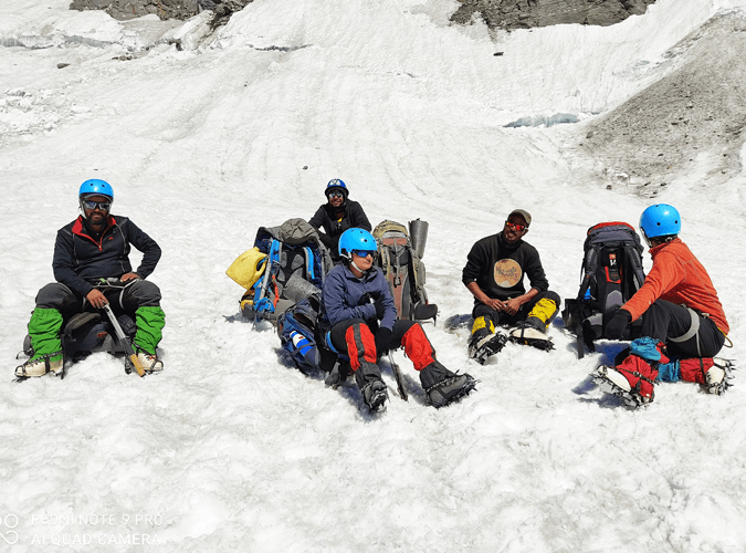
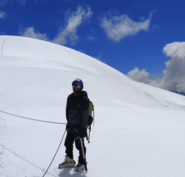
The trek to the summit attempt will begin early in the morning so have enough rest at night. The initial few kilometers are steep climbing so climb slowly and carefully on snow. A few hours later, you will see Indrasan Peak. The real problem is the lack of oxygen due to a surge in altitude. The trek is manageable but there are many deep cracks on the way. The last few kilometers are a flat walk to the summit. You can rest and spend some time at the summit but later on, return to base camp 2 due to oxygen problems.
Altitude Loss: 600 meters/ 2000 feet
Trek Distance: 3 Kilometers
Trek Duration: 3 to 4 hours
Trail Type: Steep dropping
Difficulty Level: Moderate
Water Sources: Have enough water sources
So, now after the summit, the return journey begins. Be careful as now we are moving downwards, keep your knees a little tight so that you do not fall. The same path will be followed as we move upwards. Try to reach till lunchtime so that you can have ample rest for the next day but do not rush as there are many rocks on the way.
Altitude Loss: 1400 meters/ 4600 feet
Trek Distance: 16 Kilometers
Trek Duration: 6 to 8 hours
Trail Type: Mixed steep and Flat descent
Difficulty Level: Moderate
Water Sources: Ample sources of water
This is your last tent stay so enjoy that to the fullest and try to reach early so that you can have fun. The path is mixed as it is steep somewhere and at times it is a downward walk. It takes less time in descent so you will cover a lesser time period. As it takes 6 to 8 hours so it is better to carry your lunch along with you.
Altitude Loss: 1050 meters/ 3450 feet
Trek Distance: 5 Kilometer
Trek Duration: 2.5 to 3 hours
Drive Distance: 12 Kilometers
Drive Duration: 1 hour
Trail Type: Easy
Difficulty Level: Moderate
Water Sources: Numerous water sources
Finally, trek and drive back to Manali after completing the challenging trek. Just trek to khanol and then drive to Manali. Walk carefully to avoid any injury. Collect all your equipment as it is time to say goodbye to the hills.
© 2024 All Rights Reserved - Mountains Heights